Travel back in time to the San Francisco of the 1800s!

Two developers incorporated 13,000 old photos into an interactive map of the city
Two developers incorporated 13,000 old photos into an interactive map of the city
A really interesting project, called OldSF, was launched by programmers Dan Vanderkam and Raven Keller. In an attempt to help people discover the history behind the places they see every day, they put together a map (based on Google maps application) with photos of the old city of San Francisco. When you zoom in on a particular area, photos taken during the 1850-2000 period are presented. The creators studied the photo subjects and their descriptions and were able to geocode the images, associating latitudes and longitudes to them. From the total of about 40,000 images provided by the San Francisco’s public library, almost half of them could be placed on the map, as the rest have little geographic context (e.g. they're portraits). The coders processed 13,000 images (about 65% of the available ones), many of which are shot before the big earthquake of 1906 after which the city’s architecture and planning inevitably changed.
The story behind this project
Several years ago, Dan Vanderkam searched for his cross-streets in the Public Library’s Historical Photograph Collection and was surprised to find a photo taken from his own roof! Unfortunately, the image was mislabeled and he was so bothered by this mistake that he came up with the idea of placing all the images on a map to ensure accuracy. He even put together a now-and-then shot of the photo that inspired him for this project.
See below some of them from the 1850-1900 period.
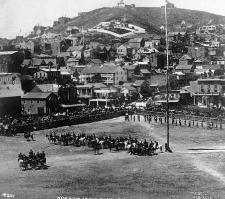
Washington Square July 4, 1862 /
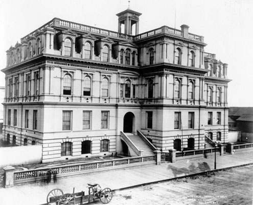
Lincoln School on Fifth Street, in 1865 /
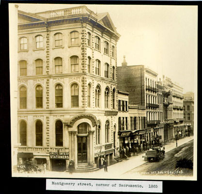
Montgomery Street, Corner of Sacramento, 1865 /
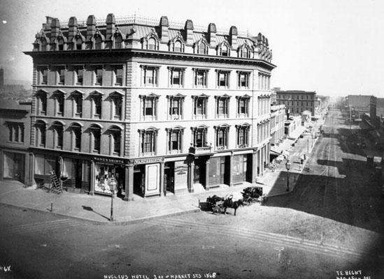
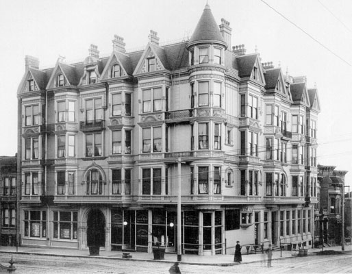
Nucleus Hotel, 3rd and Market streets, 1868 /
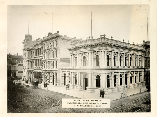
Bank of California California and Sansome Sts. San Francisco, 1868 /
Hotel Mirabeau, southeast corner of Ellis and Leavenworth streets, 1891 Apr. 4 /
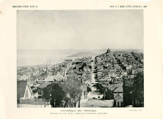
PICTURESQUE SAN FRANCISCO, Bird's-eye View from Corner Lombard and Hyde Streets, Looking East.
ca. 1897 /
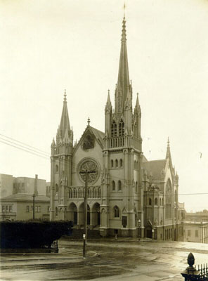
St. Paulus German Evangelical Lutheran Church. Eddy and Gough streets. 1899 /
Want to read more like this story?

Sinking and tilting of San Francisco’s Millennium Tower has led things to courts
Feb, 20, 2017 | NewsIn 2016, it became public that the 58–story skyscraper - the biggest residential building of San Fra...

Waste is upcycled into bricks for streets in Nairobi
Jan, 24, 2018 | NewsMaterials that have ended up in the dumpsite can benefit the community while also creating unique st...

The Millennium tower of San Francisco is being sunk!
Aug, 04, 2016 | NewsThe Millennium Tower is a high-rise luxurious building and a landmark of San Francisco. The...

San Francisco Puts Earthquake Warning Signs on Buildings
Sep, 18, 2014 | NewsIn a controversial move last week, San Francisco placed warning signs on buildings that violate San...

New Guidance for San Francisco High-Rise Foundations
May, 10, 2018 | NewsNew tall buildings in San Francisco to comply with updated guidelines for foundation peer review and...
Awards of sophisticated civil engineering for two California projects
Nov, 24, 2022 | NewsTwo California projects its San Francisco section 2022 project awards were awarded from the America...

Google Street View cars used for high-resolution air pollution mapping
Jun, 12, 2017 | NewsThis new approach towards urban air pollution mapping offers much greater spatial precision in compa...

Solar-kinetic street lighting in Las Vegas!
Mar, 08, 2016 | NewsIt is the first time this off-the-grid street lighting technology will be applied, combining kinetic...

California Highway 1 re-opens a year after landslide
Jul, 30, 2018 | NewsA section of Highway 1 in California re-opened 14 months after a major landslide buried the road whi...
Trending

Taipei 101’s impressive tuned mass damper

Characteristics of Load Bearing Masonry Construction

Understanding the Carola Bridge Collapse: Expert Insights

This powder offers an innovative solution to water purification

Dutch greenhouses have revolutionized modern farming

Formwork failure causes roof slab collapse in Limassol construction site

