2019 Geospatial Industries Totally Worth Checking Out

With a new year comes new technological strides—or should we say, leaps and bounds? It’s almost hard to keep up with the dizzying number of emerging trends and developments in the mapping & geospatial field—which is why we’re here to ‘map’ them out for you. We’ve got our eye on these up-and-coming geospatial technologies in 2019 (and you definitely should, too!).
1. Automotive Industry
We’ve written in the past about the innovations in underground navigation, but there’s a lot of good work being done in cars today, too. We’ve gone from personal cars that were connected to satellites in space to autonomous cars that are completely self-driving, as seen in the latest navigation “solution” from Google.
But what’s going on in the automotive industry that average consumers can enjoy? A lot. Take Volkswagen, for example. In late 2018, they announced that its VW Car-Net mobile app added a new feature for Apple device users. Now, you’re able to talk directly to Siri and issue car commands such as locking and unlocking the vehicle, and checking estimated mileage. Now as you’re walking up to your car, hands loaded with groceries, you can simply speak into your connected Apple watch and say, “Hey Siri, unlock my car”. Other short cuts include climate temperature commands and a “Where is my car?” feature. If you don’t believe us, just head over to a Volkswagen dealer to see this innovative tech for yourself!
2. Maps
It might sound ominous but indoor and underground mapping will totally change the way we live our lives in 2019. Integrated HVAC systems will decrease energy consumption, corporate campuses will better allocate resources, healthcare delivery at hospitals will become more efficient, and transportation hubs will make traveling more pleasant. The list goes on and on!
3. Drones
Geospatial drones go hand in hand with indoor mapping technology. You’ll also see developments in the drone geofencing technology you’ve seen develop over time with enhancements from DJI.
Remember, it’s always smart at the turn of the new year to check in with the latest 2019 laws that may require you to register your favorite hobby with the FAA.
 4. Apps
It seems like today, nearly every mobile app contains some sort of geospatial feature; and that could be serving local advertisements or connecting you to friends nearby to enhance UEX. But in 2019, we’re seeing a host of new apps that are designed for us folks who are obsessed with geospatial products, such as:
- Collector for ArcGIS: This data-collection software lets you update maps, make notes, and add photos or videos.
- Mapit GIS: It’s field data and survey collection software that enables you to organize information into editable layers for exportation.
- SW Maps: This free, beginner-friendly app is a great starting place for anyone looking to get involved with geospatial mapping.
… and much, much more. If you want the most out of your GPS receivers this year, you need to check these out.
5. Geo Business
Geospacing analytics is poised to be huge in 2019, specifically with relation to graphics processing units (GPUs) over computer processing units (CPUs). As a result, EO imagery such as deep learning will begin to takeoff to new heights. You’ll see businesses exploring massive databases with GPU-acceleration to make queries instantaneous at zero-latency speeds.
How exactly these advanced tech trends will shape the future of geo business, we’re not quite sure. Profit margins will increase and customer satisfaction will undoubtedly improve, but we’ll have to wait and see how exactly it’ll begin to shape the economy.
6. Start-Ups
The future is all about innovation and this list of 2019 Top 100 Geospatial Companies and Startups demonstrates just how strongly that statement rings true. You’ll see how the older tech giants are being thwarted by newly founded startups like StreetCred (est. 2018). StreetCred is just one of these young, up-and-coming companies who are changing the geospacing game, in this case by offering accessible data for places people care about.
Want to read more like this story?

Smarter Cities Start with Better Maps: Geospatial Tech and Sustainability
May, 01, 2025 | NewsAs urban populations grow and the climate crisis intensifies, civil engineers and urban planners ar...
London to create a digital map of underground infrastructure
May, 20, 2019 | NewsLondon officials are planning to create a digital map with the city's underground network of pi...
Elon Musk introduces underground transportation breakthrough
Jan, 07, 2019 | NewsElon Musk, CEO of Tesla Motors, has invented a futuristic solution to end urban traffic. 2 years...

Unpiloted vehicles can reduce congestion by more than 35%
Jun, 13, 2019 | NewsA new study shows that unmanned vehicles operating together can reduce traffic by more than 35%....
Capturing Reality with Drones - The future is here for construction business
Jan, 31, 2017 | NewsRapid increase in UAV 3D Mapping technology implementation in various scientific and industrial proj...
Satellite data and AI drive the next wave of sustainable infrastructure in the UK
Oct, 03, 2025 | NewsThe United Kingdom is advancing the integration of satellite data and artificial intelligence (AI...

Harnessing Drone Technology for Highway Construction
Jun, 25, 2024 | NewsIn recent years, the integration of drone technology in civil engineering has revolutionized the in...
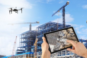
Drones maintain construction timetable and budget under control
Sep, 14, 2018 | NewsDrones are a perfect tool to supervise and control a construction process in order to keep the proje...

Google Street View cars used for high-resolution air pollution mapping
Jun, 12, 2017 | NewsThis new approach towards urban air pollution mapping offers much greater spatial precision in compa...
Trending

Vertical gardens in Mexico City to combat pollution

Characteristics of Load Bearing Masonry Construction

Taipei 101’s impressive tuned mass damper

Saudi Park Closed After 360 Big Pendulum Ride Crashes to Ground, 23 injured
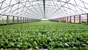
Dutch greenhouses have revolutionized modern farming

Federal court rules Biden’s offshore drilling ban unlawful


