
Software
Create a free account and view content that fits your specific interests in civil engineering Learn More
Software

On prem or cloud based geodatabase management software designed to store, manage and analyze geological and geotechnical data with compliance.
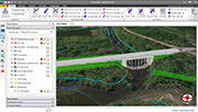
GeoHECRAS is an AutoCAD, MicroStation and ESRI ArcGIS compatible interactive 2D/3D graphical user interface data wrapper to the US Army Corps of Engineers HEC-RAS.

GEOSYSTEM Software’s signature application is our boring log module, LD5. Licensed to more than 600 companies, LD5 simplifies the process of site exploration reporting with its comprehensive logs for...
Genesis Logger utility is a Microsoft® Access based utility that provides the framework for a fully integrated geological database.

GEO-LOG 3 is a geotechnical data processing software with custom layout of borehole logs.

Geo-Log 4 is an internet software that can be used for geotechnical investigations, allowing management and processing of data online!

GeoDin
€ 2.394,70
GeoHECRAS
US$ 4.000,00
GeoIntegrate offers a modern, cloud-based approach to geotechnical data management and boring log production for engineering firms looking to transition from traditional desktop-based systems.

The GeoIntegrate Field App brings subsurface investigation data collection into a modern digital workflow, helping field personnel record exploration information efficiently while reducing repetitive...

GEOSYSTEM LOGDRAFT V5
US$ 1.500,00
Geotec is a comprehensive geotechnical, environmental and geomechanical data management software. Geotec optimizes data management for all your investigation campaigns from field to final reports.

Geotechnical Information Management System (GIMS) -
Software as a Service (SaaS)
A Web-Application Solution for your daily Geotechnical Data Management. GIMS is an innovative and smart tool that...
