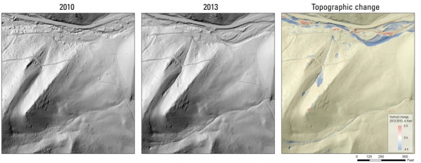
Heavy rains in 2013 lead to devastating floods of rock, soil, and water through many cities and towns that line the Colorado Rockies. Scientists are now considering the importance of large, rare, independent storm events in determining an area’s landscape. Scott Anderson, a geomorphologist with the U.S. Geological Survey in Tacoma, Washington and lead author of a new study stated that "while it strikes us as very random, our research suggests this is one of the formative processes in this landscape."
Heavy rains in 2013 lead to devastating floods of rock, soil, and water through many cities and towns that line the Colorado Rockies. Scientists are now considering the importance of large, rare, independent storm events in determining an area’s landscape. Scott Anderson, a geomorphologist with the U.S. Geological Survey in Tacoma, Washington and lead author of a new study stated that "while it strikes us as very random, our research suggests this is one of the formative processes in this landscape."
Historic floods in Colorado in 2013 resulted in more than 1,100 landslides and debris flows in the Front Range after several days of unusually heavy rain in September. The debris flows carried huge volumes of rock and sediment down mountain valleys, scouring out river channels like sandpaper. According to Anderson, “The erosion that occurred during this one event represents the removal of hundreds to a thousand years of accumulated debris.”
To determine exactly what impact the floods had, geomorphologists first had to find how much erosion occurs in an average year due to springtime thaw, tree root movement, animal disruption, and other expected movements through radioactive dating. The upper layer of soil is constantly bombarded by cosmic rays, creating radioactive atoms that begin decaying at a regular rate. It was found that the Front Range of the Colorado Rockies is weathering away near a rate of 20-60 millimeters every 1000 years.
When the scientists compared this data to those measurements taken during and after the flooding in 2013, it was clear that this one-time event made a lasting impact. Using 3-D maps from before and after the flooding the scientist identified 120 landslides, which moved more than 114,000 cubic meters of debris. Within the debris flow channels, the floods removed up to 1 meter of rock and sediment. The total amount of erosion averaged, over the entire landscape measured in the study was 15 millimeters. That amount of erosion is comparable to the amount of lowering, that takes place over millennia along the Front Range. “The supposition is that most of this material was shot out downstream and onto the plains,” said Anderson. "The presence of so many debris flows in this semiarid landscape is pretty novel."
Sources: Live Science, Wired
Sources: Live Science, Wired
Want to read more like this story?
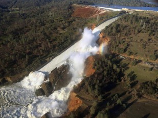
New study explains how global warming significantly increases the size of floods
Feb, 03, 2020 | NewsAccording to new research evidence, warming environment leads to more rainfalls and less snow accumu...

Flood risk increase for US infrastructure due to climate change: Insurance rates tend to underestimate the current conditions
Mar, 01, 2021 | NewsThe risk of flooding can cause severe damage to infrastructure. New evidence revealed that the poten...
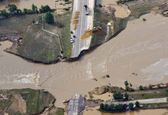
How can twitter help engineers assess infrastructure performance: the Colorado floods case
Sep, 04, 2014 | NewsLast year's massive flooding in Colorado's Front Range affected a widespread area, destroyed roads a...

New satellite mission will enable better flood prediction modeling
Sep, 30, 2019 | NewsAccording to a recent study, a new satellite, set to launch in 2021, will offer a better understandi...
Road collapse caught on video as flooding and landslides hit Turkiye
Jul, 12, 2023 | NewsFloods and landslides have occurred in northern Turkiye, starting July 10, due to heavy rainfall th...
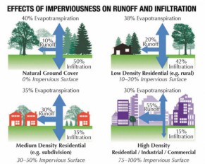
Evaluating the impact of urban development on flood risk
Feb, 13, 2020 | NewsAccording to a new study, urban development may cause severe issues when it comes to flooding risk....
Landslide on central B.C. coast caused lake tsunami more than 100 meters high: UNBC study
May, 03, 2022 | NewsLandslide on central B.C. coast caused lake tsunami more than 100 meters high: UNBC study An e...
Study: Ice Age Cycles Had Little Impact on Global Weathering Rates
Jun, 10, 2015 | NewsA team of researchers from Stanford University and Germany’s GFZ Research Center for Geoscienc...

Flooding in China Causes Landslides and Leaves Over 170 Dead
Jul, 12, 2016 | NewsLast week, widespread flooding in the Yangtze river basin in China has left over 170 dead and millio...
Trending

Vertical gardens in Mexico City to combat pollution

Saudi Park Closed After 360 Big Pendulum Ride Crashes to Ground, 23 injured

Characteristics of Load Bearing Masonry Construction

Taipei 101’s impressive tuned mass damper

Dutch greenhouses have revolutionized modern farming

Federal court rules Biden’s offshore drilling ban unlawful


