Capturing Reality with Drones - The future is here for construction business
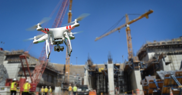
Rapid increase in UAV 3D Mapping technology implementation in various scientific and industrial projects is about to invade the construction industry.
Rapid increase in UAV 3D Mapping technology implementation in various scientific and industrial projects is about to invade the construction industry.
According to a March 2016 report from Goldman Sachs, construction will be the largest use case for commercial drones in the immediate future, generating $11.2 billion of the projected $100 billion in global spending over the next five years.
Capturing reality with camera enabled drones is not a new story. Many industries already benefit from spatially accurate and detailed 3d products for a few years now. One could ask archaelogists, quarry surveyors, environmental engineers, agriculture engineers and other engineer consultants for this matter and pretty much receive the same answer 'drones increased efficiency while adding a whole new perspective on how we understand and manipulate natural and human made surroundings'.
For instance, Pignano Roman theatre in Volterra, Italy was recently virtually recreated and monitored using drones, cameras and laser scanners to produce textured, 3D mesh models and animated videos of its archaeological remains and some of its treasured artwork, as part of an international reality capture workshop from Oct. 10 to 22, with Pittsburgh-based Civil & Environmental Consultants (CEC), Volterra Detroit Foundation, Case Technologies, Autodesk and 3D Robotics.
Now that drone technology is in a 'maturing' process, with more reliable and better camera equiped drone models up in the air (or even indoor) and Structure from Motion software getting more accurate and project oriented, construction industry is about to claim its piece from the pie. Rich aerial data captured and detailed—and financially valuable—3D models of earthwork and building sites generated could be implemented in Building Information Modeling standards while construction safety is evolving as another powerful case for using drones, as Hunter Cole, who is part of the Virtual Design and Construction team at general contractor Brasfield & Gorrie. Cole—along with Brasfield & Gorrie colleague Jesse Creech— presented in “Drones in Construction” lecture at the 2016 Autodesk University conference in Las Vegas. “Reality capture gives teams a new perspective to see every detail of a site in its current state and from a remote location,” Cole said. “We can plan workflows and develop safety and site logistics plans that identify high traffic areas, crane clearances and areas where material will move in and out.”
The future for construction companies using drones is likely to get even rosier under “Part 107,” the FAA’s new rules governing the use of drones by commercial operators. Under the regulatory framework enacted in August 2016, a traditional pilot’s license is no longer required to operate a small unmanned aircraft. Instead, passing a knowledge test can grant an applicant a certificate specific to flying a drone. What the new rules mean for construction companies, Cole said, is a much more flexible path to getting in the air. “This is a huge accelerator for commercial organizations. A month ago, we had one certified pilot. Now we have seven.”
Drones and reality capture is not a future concept anymore, it is a powerful and evolving technological leap forward already taken by many industries in the scientific and engineering world, with many more yet to follow.
Source: Engineering.com
Source: Engineering.com
Want to read more like this story?
Harnessing Drone Technology for Highway Construction
Jun, 25, 2024 | NewsIn recent years, the integration of drone technology in civil engineering has revolutionized the in...
Drones maintain construction timetable and budget under control
Sep, 14, 2018 | NewsDrones are a perfect tool to supervise and control a construction process in order to keep the proje...

Civil Engineering in the Digital Age: Top Innovations Shaping the Future
Jul, 16, 2024 | NewsThe world of civil engineering is experiencing a significant digital transformation. Innovative tec...
3D printing: team of flying robots to build structures
Oct, 11, 2022 | NewsTeams of airborne 3D-printing drones could one day be used to complete construction projects in dan...
How drones have affected Construction Industry
Nov, 20, 2018 | NewsIn the last years, drones have become an advantageous device, widely used in construction industry,&...
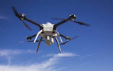
Cowi employs drones for dam surveys in Zambia
Mar, 10, 2017 | NewsThe company is using the drones for topographical measurements regarding the construction of 100 dam...

Drones in the Arctic Sea
May, 27, 2015 | NewsOne of the main jobs of geotechnical engineers is collecting and reporting data from the field. &nbs...

The correlation between direct work and productivity in construction industry
Jul, 16, 2020 | NewsA new study focuses on a crucial relationship that impacts the construction industry. The correlatio...

Landmark Approval: BVLOS Drones Cleared for UK Rail Surveillance
Jun, 19, 2025 | NewsThe UK Civil Aviation Authority (CAA) has authorised Drone Major Group to conduct the country’s fir...
Trending

Taipei 101’s impressive tuned mass damper
Characteristics of Load Bearing Masonry Construction

China Completes World’s Longest Expressway Tunnel, Redefining Connectivity
The Line at Neom faces feasibility reassessment while construction continues


