Software
Create a free account and view content that fits your specific interests in civil engineering Learn More
Commercial Software

Integrated Foundation Engineering, from the plan to the analysis
GEOTEC Office is a package for geotechnical and design engineering.

The new version is the culmination of a long list of new features and enhancements developed in recent months.

SCALE is a computer program for producing structural engineers' calculations and component details for the design of a variety of components.
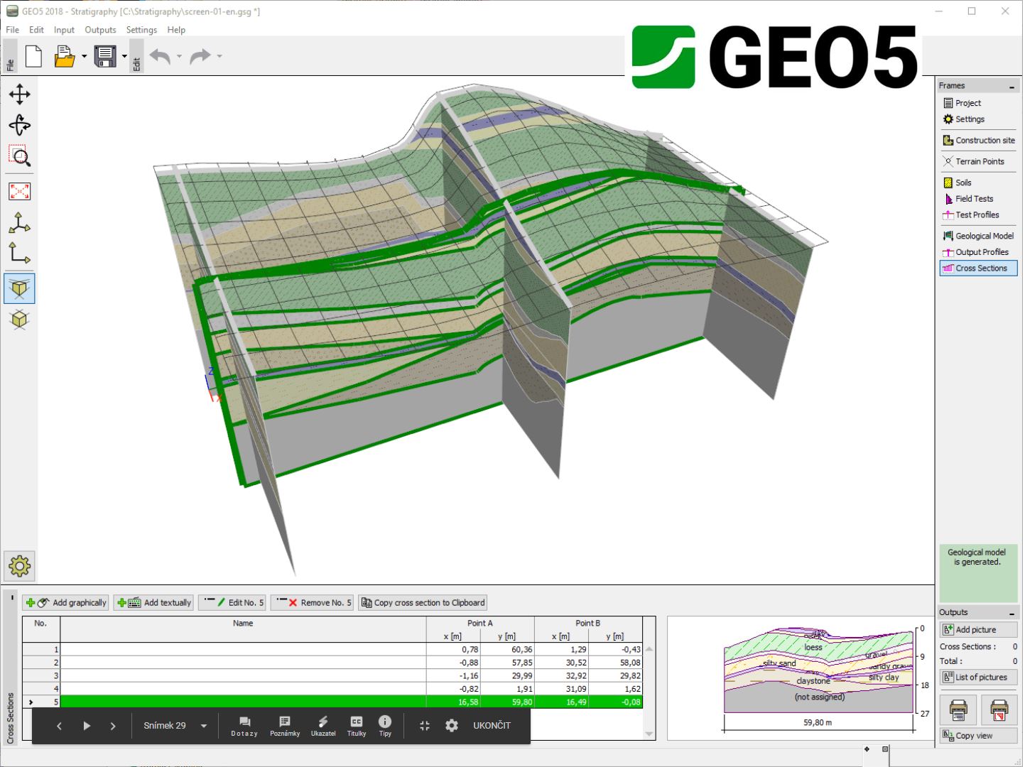
The GEO5 Stratigraphy program is designed to process results from site investigation (boreholes, wells, CPTs, DPTs, SPTs, DMTs ...), generate 2D or 3D geological models and export cross sections and g...
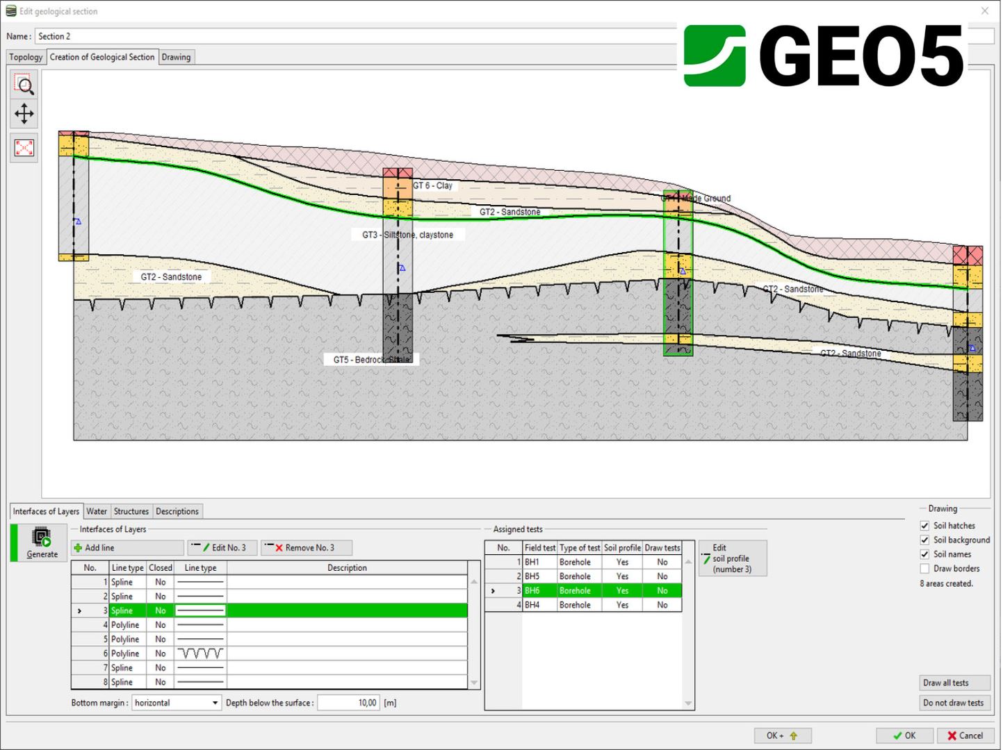
The Stratigraphy - Cross Sections module is designed for easy creation of geological cross-sections (including lenses, faults). It provides scaled outputs of the cross-section with field tests and soi...

The Stratigraphy - Logs module is used for geological data reporting from site investigation (boreholes, wells, SPT, CPT, DMT and more). It provides a comprehensive database of pre-defined templates a...
DC-Integra
€ 1.250,00
GEOTEC Office
€ 1.500,00
PROKON 2.6
US$ 2.400,00
SCALE
£ 950,00
- Civil
- Commercial
- Engineering Geology Deep Excavations Retaining Walls Foundation Design / Construction Shallow Foundations Groundwater & Seepage Borehole Logging Settlements Structural Geology Tunneling Tunneling In Rock Tunneling In Soils Underground Structures Other Geotechnical Mechanically Stabilized Earth (Mse) Walls Deep Foundations Pile Foundations Shaft Foundations Caisson Foundations
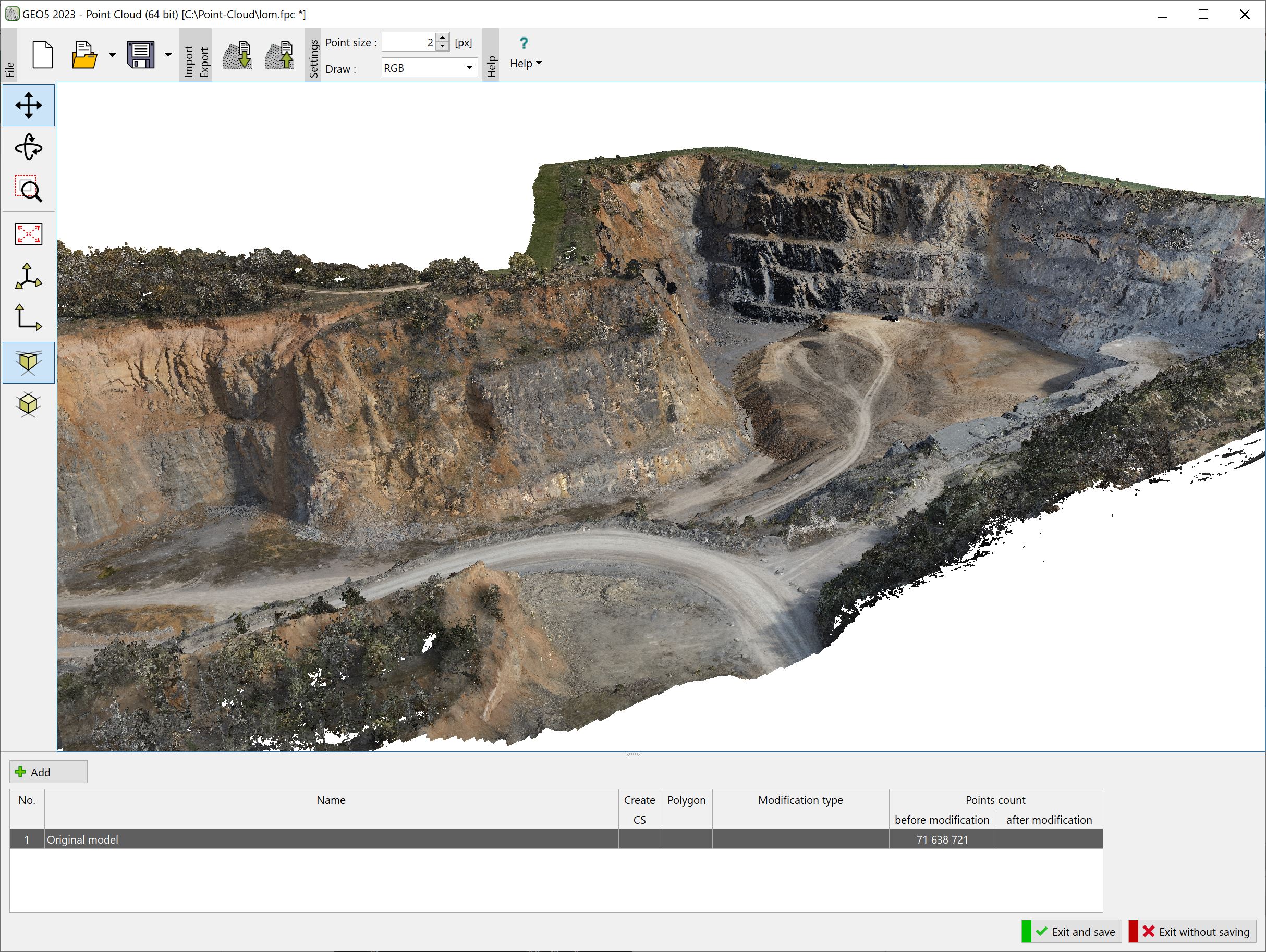
The program allows fast processing of point clouds (up to 100 million points) and export of resulting points into the Stratigraphy program or external files.
GEO5 Stratigraphy
€ 600,00
GEO5 Stratigraphy - Cross Sections
€ 550,00
GEO5 Stratigraphy - Logs
€ 600,00
The Earthworks module is designed for modelling structures, such as foundation pits, roads, railways, quarries, slopes, and others. It also provides calculation of earthwork or terrain movement volume...
