Displaying Items By Tag: Building Facade
Create a free account and view content that fits your specific interests in civil engineering Learn More
News on building facade
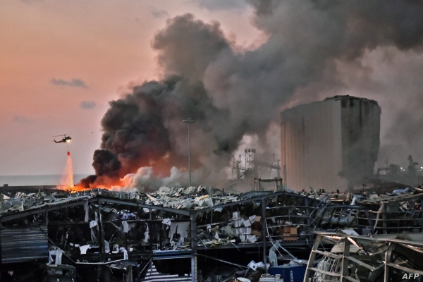
Assessment of the infrastructure damage after the 2020 Beirut explosion, Lebanon
Researchers have managed to utilize ground mapping and satellite imagery to map and assess the infrastructure damage that followed the disastrous Bierut explosion which occurred in Lebanon, 2020. I...
Read More