Displaying Items By Tag: Lidar
News on LiDAR
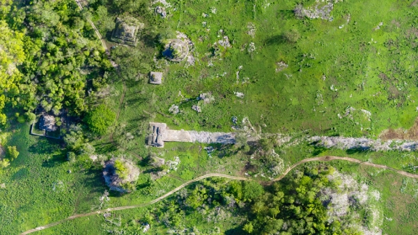
LiDAR study reveals information about great Maya road
Scientists utilized LiDAR data to study the longest road constructed during the Maya era. LiDAR (Light Detection and Ranging) technology is a remote sensing technique that measures distances using...
Read More
Old fort landslide caused by bedrock failure: People return home
The Old Fort landslide, a mass movement that caused the evacuation of about 50 residences, was caused by a bedrock failure. The Old Fort landslide, a mass movement that caused the evacuation of about...
Read More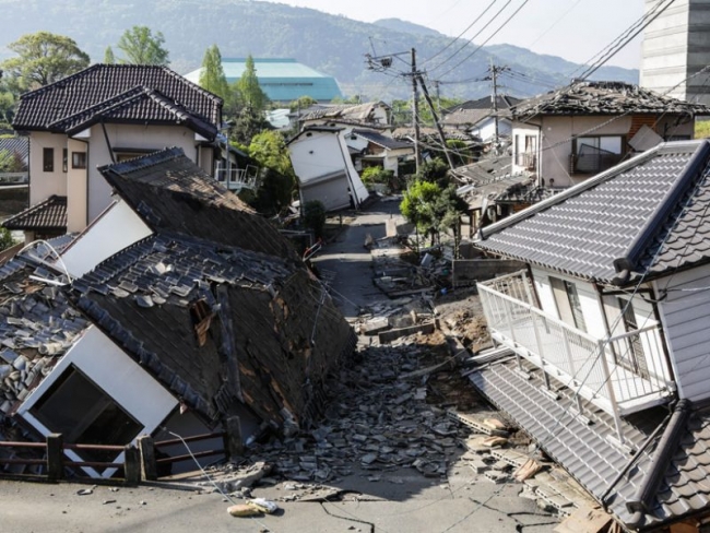
Damage Assessment by Laser Could Focus Post-Earthquake Response
Airborne lidar surveys taken before and after a powerful 2016 earthquake in Japan revealed the potential for such surveys to identify hard-hit buildings quickly. Airborne lidar surveys taken before a...
Read More
Washington employs LiDAR technology against landslide risk
Washington's Department of Natural Resources (DNR) is making use of the best technology available to collect, analyze, and publicly distribute detailed information about the state's geology, through a...
Read More
Virtual Reality system offers engineers new monitoring perspectives!
An innovative virtual reality system, developed in the UK, for various engineering purposes, aims in helping scientists as well as medium-sized engineering firms simulate and visualize any working env...
Read More